The Ordnance Survey (OS), established in 1791, has a long association with Southampton.
Britain’s mapping agency has its roots in military defence. This was started following the defeat of the Jacobite rebellion in 1745. It took eight years to map he Scottish Highlands.
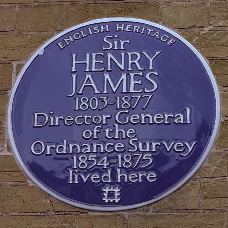
Then during the Napoleonic Wars, up to 1815, there was a fear of a French invasion of England’s southern coast. The defence ministry of the time was called the Board of Ordnance, and they surveyed the south. Accurate maps were needed to move troops and plan campaigns. Until 1974 all Director Generals held an army rank and the last military personnel left the OS in 1983.
From 1824-1855 Ireland, England and Scotland were surveyed for accurate land taxation. In 1935 the Retriangulation of Great Britain began lasting until 1962. Many concrete Trig Pillars to mount theodolites remain on high points. Also, many benchmarks can still be found on buildings as over 500,000 were created until 1993. They were part of the national height above mean sea level system until replaced by GPS technology.
The original building situated at the south end of the Avenue on the west side, was built in the late 18th century as a cavalry barracks. Cessation of the French Revolutionary Wars with France after the 1815 Battle of Waterloo rendered the barracks redundant.
The building was converted in 1816 into a branch of the Royal Military Asylum then based at Chelsea. At one time the asylum catered for up to four hundred orphan boys from military families, and girls from 1823.
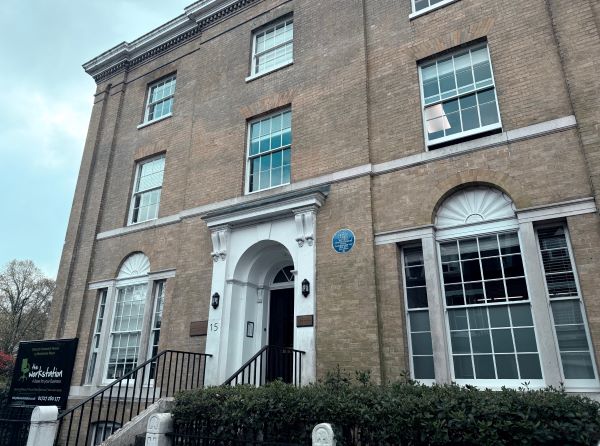
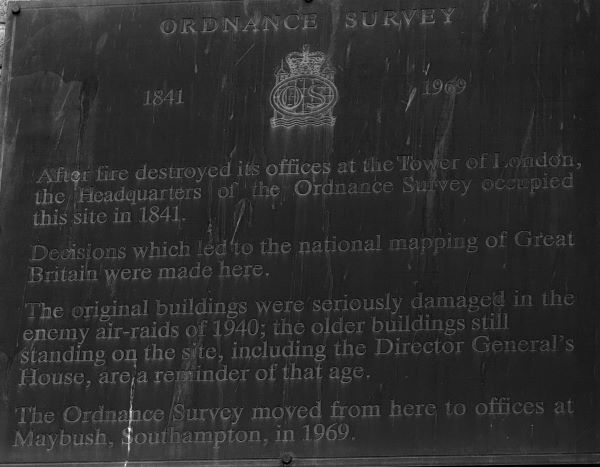
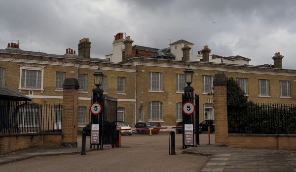
In 1841 an Ordnance Survey office was established on the site, after a fire at the Tower of London had destroyed their London offices. Between 1841 and 1867 new buildings were added and the original 18th century cavalry barracks buildings were demolished by 1873.
The buildings received some damage in the Blitz of 1940. The US military arrived in Southampton in the summer of 1943 in the build-up for D Day in June 1944 and still had segregation. The London Road buildings were the HQ for the black American soldiers. The surviving buildings in London Road are from the mid-Victorian rebuilding.
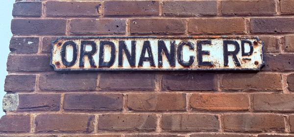
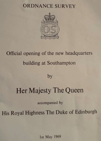
In 1969 a new permanent headquarters for 4,000 plus staff was opened on the Crabwood House site alongside Romsey Road at Maybush.
In 2010 the OS moved to Explorer House at Adanac Park, Nursling, opened in 2011 by the Duke of Edinburgh. Adanac is Canada backwards. In World War 2, Canadian troops were stationed at various points around Southampton including Millbrook where in 1951 a retirement housing complex, named Toronto Court, was built by the Council.
- In Common is not for profit. We rely on donations from readers to keep the site running. Could you help to support us for as little as 25p a week? Please help us to carry on offering independent grass roots media. Visit: https://www.patreon.com/incommonsoton